Afternoon Showers Set to Break Warm Spell in Hobart

Afternoon Showers to Follow Warm Morning Peak
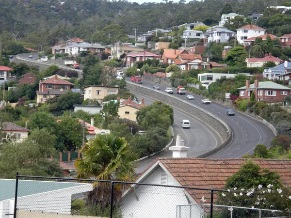
Hobart residents should keep their umbrellas within reach today, Wednesday, February 11, 2026, as a shifting weather pattern is set to bring a high chance of afternoon showers across the city. While the day is expected to start with a pleasant summer warmth, the atmosphere will become increasingly unstable as we move into the second half of the day, marking a distinct change from the clearer conditions seen earlier in the week.
Morning Outlook: A Mild and Cloudy Start
The morning hours are predicted to be mostly cloudy, providing a relatively soft start to the day. Temperatures will climb steadily from an overnight low of 11°C. By the time most residents are heading to work or school, the mercury is expected to be around 17°C. Despite the cloud cover, conditions will remain dry throughout the morning, making it the ideal time for outdoor exercise or morning errands. Humidity levels are expected to sit comfortably at approximately 58% during this period, with light to moderate breezes providing a comfortable environment for commuters.
Afternoon Heat and the Shift to Showers
As we transition into the afternoon, Hobart will experience its peak temperature for the day, reaching a maximum high of 26°C. This warmth may be short-lived, however, as a trough moves across the region. Meteorologists have forecast a high chance of showers—with some models suggesting an 80% probability—with the most likely window for rainfall occurring between mid-afternoon and the early evening commute. These showers are expected to be light but persistent enough to dampen the city streets, with total rainfall likely between 1mm and 5mm.
Wind patterns will also play a crucial role in today’s weather transition. Early north to northwesterly winds of 15 to 25 km/h will provide a warm breeze throughout the morning. However, these are expected to turn westerly and intensify by the late afternoon. Gusts could reach between 20 and 30 km/h, which will herald the arrival of cooler air and cause temperatures to dip noticeably before sunset.
Evening and Overnight Forecast
By the evening, the showers are expected to taper off, leaving behind a partly cloudy sky. The temperature will descend back toward the low teens, ensuring a cool and comfortable night for the city. Those attending outdoor evening events or late dinners should be prepared for damp surfaces and the lingering possibility of a light sprinkle as the system moves further east.
Key Weather Data and Safety Reminders
- Temperature Range: A daytime high of 26°C following an overnight low of 11°C.
- Wind Conditions: Northwesterly 15-25 km/h, shifting to Westerly 20-30 km/h in the late afternoon.
- Precipitation: High chance of afternoon showers; 40-80% probability with 1-5mm expected.
- UV Index: Predicted to reach 9 (Very High). Sun protection is strongly recommended between 10:00 AM and 4:30 PM.
While there are currently no severe wind or flood warnings in place for the Hobart metropolitan area, motorists are advised to take extra care on the roads during the afternoon peak hour as the first of the showers may create slippery conditions.
Zen in the Park and Tall Ship Adventures: Your Hobart 'What’s On' for Tuesday

Sun, Strength, and Simpler Scripts: Your Hobart Morning Briefing
Lane Closures and Speed Restrictions: Commuter Update for Southern Outlet and North Hobart